Shafeen Alam
All work
Route PostalSelf-initiated explorationWorking prototype

Finding the next doorstep, with less screen time

On an unfamiliar route, the address on a scanner doesn’t always tell you which house is in front of you. I built Route Postal to help carriers recognize the next stop and make the delivery without constantly reaching for their phone.

Role
Product Designer and builder
Context
Self-initiated
Started
October 2026
Platform
iPhone + Apple Watch + Meta Ray-Ban Display glasses
case.md
$ cat status
status: working prototype
audited: 13 screens on device
measured: no results yet
version: v1.0 · Nov 2026
Why it mattered

Finding the right house should take a glance.

60-second read

Problem

When a house number is hard to see, an address list only gets a carrier so far.

System decision

Plan on iPhone, hear the next stop on Apple Watch, and see nearby houses through Meta Ray-Ban Display.

My contribution

I defined the carrier workflow, designed and built all three apps, and connected them so each device follows the same delivery.

Status

I walked through a sample route from setup to the last delivery. The next step is to try it with carriers on a real route.

In motion

Follow one delivery across three devices.

Pick a moment on this fictional route to see what changes on the phone, Watch, and glasses.
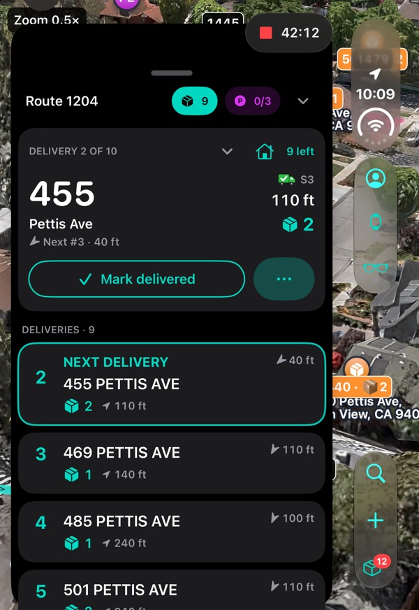
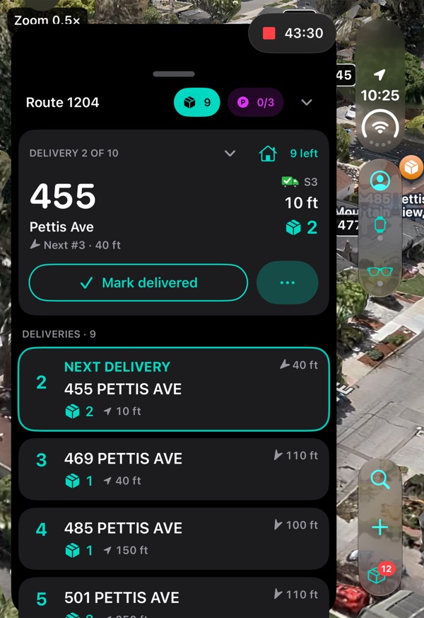
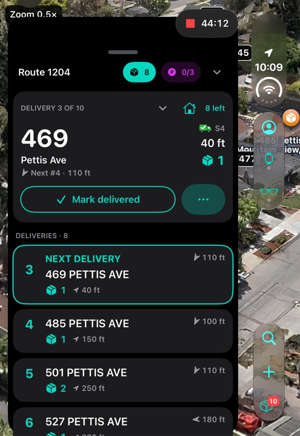
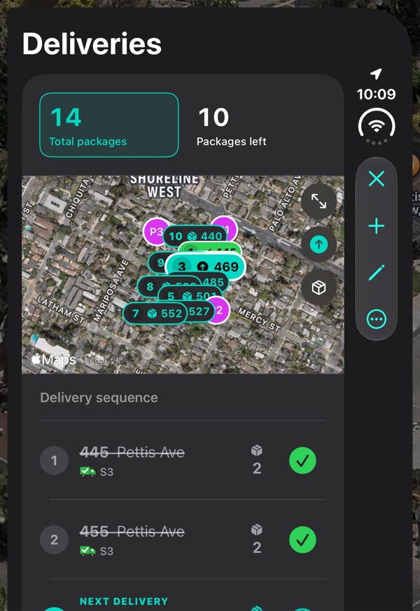
iPhone Home: Route 1204 with Delivery 2 of 10, 455 Pettis Ave, 110 ft away, and the rest of the deliveries listed belowiPhone Home with the delivery card for 455 Pettis Ave, 10 ft awayiPhone Home after delivering: Delivery 3 of 10, 469 Pettis AveiPhone Deliveries: 14 total packages and 10 left, a map of the stops, and the delivery sequence with 445 and 455 delivered
iPhone
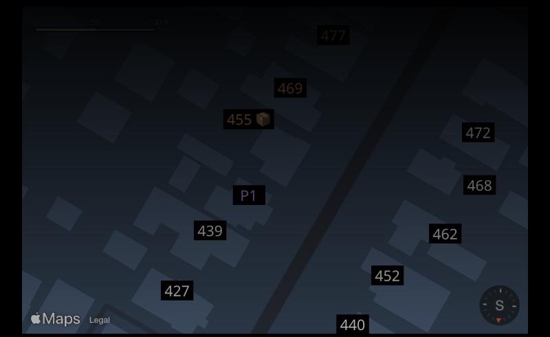
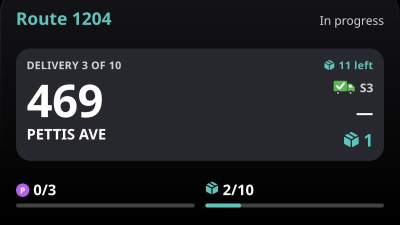
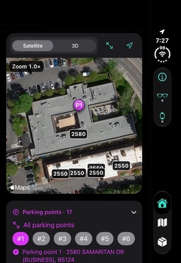
Glasses map: house numbers with 455 marked as the next package and parking point P1Glasses overview: Delivery 2 of 10, 455 Pettis Ave, 2 packagesGlasses overview: Delivery 3 of 10, 469 Pettis Ave, 1 package
Meta Ray-Ban Display · as the wearer sees it
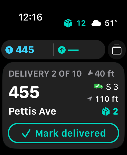
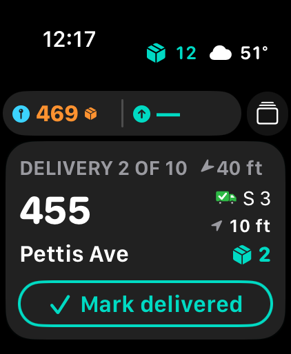
Apple Watch: Delivery 2 of 10, 455 Pettis Ave, 110 ft away, with the house you are at in the top chip and a Mark delivered buttonApple Watch: Delivery 2 of 10, 455 Pettis Ave, 10 ft away, with 469 as the next package in the top chipApple Watch after delivering: the approach screen for 469 Pettis Ave, 50 ft away, with 1 package and an arc on the ring that points at the houseApple Watch Next delivery screen: 150 ft to 485 Pettis Avenue
Apple Watch

1 · Approach. At 110 feet from 455 Pettis Ave, the phone and Watch show the distance. The glasses mark the house on the map.

01 · The problem

The address is only half the answer.

A carrier may have the right package in hand and still have to work out which door it goes to. Nearby house numbers help them place the stop on the block.

How might we help a carrier recognize the next house and prepare for a delivery without repeatedly reaching for a phone?

I started with firsthand accounts of how carriers work and refined the design through feedback.

02 · My contribution

I mapped the carrier workflow from setup to delivery, decided what each device should show, and designed the maps, photo imports, and handoffs. I built the iPhone and Watch apps in SwiftUI and the Meta Ray-Ban Display app for the glasses, using AI to help with implementation.

03 · From map to doorstep

The phone is where you set up and review the route.

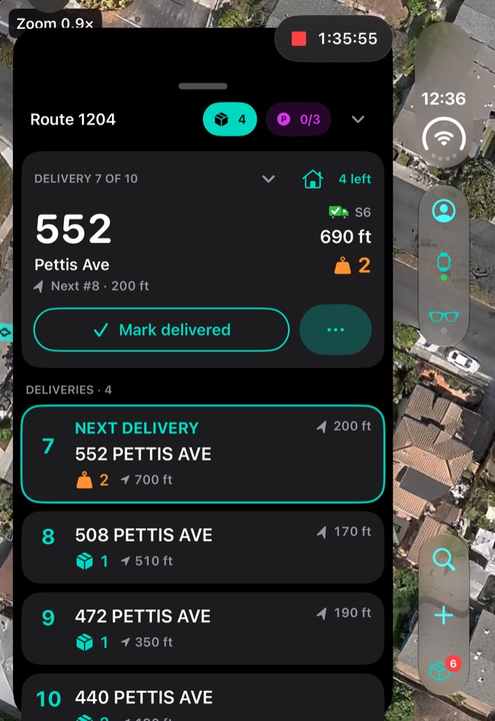
The map shows where you are, the route card shows what comes next, and the deliveries list tracks what’s left. I kept setup on the phone so the Watch and glasses could focus on the next stop.
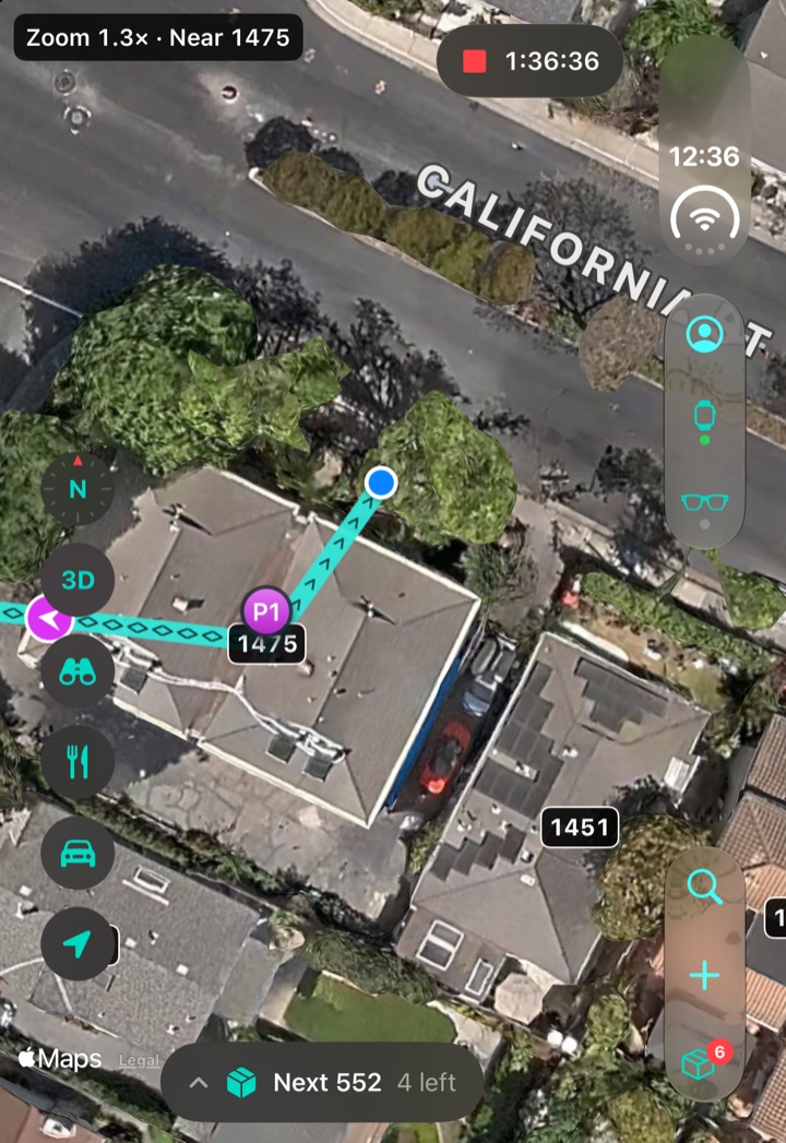
Route Postal Home mid-route: a satellite map with house numbers 1475 and 1451, parking point P1, the walked path to the blue position dot, a pill reading Next 552, 4 left, and the side column with the Watch button showing a green dot
Home. House numbers, your path, and the next stop on one map.
Route Postal route card for Route 1204: Delivery 7 of 10, 552 Pettis Ave with a heavy package, 690 ft away, a Mark delivered button, the next deliveries below, and chips for 4 deliveries and 0 of 3 parking points
Route. The route card puts the next stop, remaining deliveries, and parking points together.
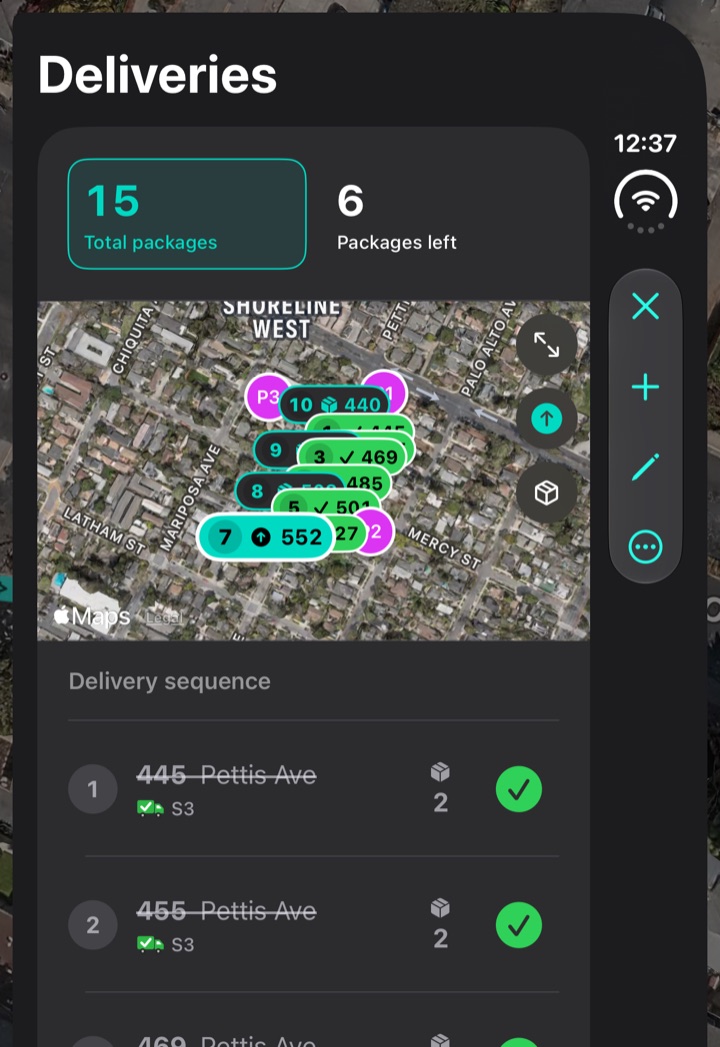
Route Postal Deliveries sheet: 15 total packages and 6 packages left, a map with delivered stops in green and 552 next, and the delivery sequence with 445 and 455 struck through
Deliveries. See what’s left and which stops are complete.
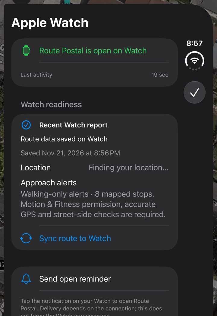
Route Postal Apple Watch status sheet: Route Postal is open on Watch, last activity 2 seconds ago, Watch readiness with route data saved, current Watch location available and approach alert requirements, plus Sync route to Watch and Send open reminder
Watch status. Check Watch readiness, sync the route, or send a reminder to open the app.

Decisions on the street

Did I pass that house? Should I drive closer with a heavy package? What does the front door look like? These screens help answer those questions in the moment.
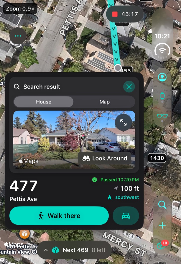
Search result for 477 Pettis Ave: Look Around photo of the house, Passed 10:20 PM, 100 ft southwest, a Walk there button and a car button
Mail lookup. The walked path shows you’ve passed this address. You can walk or drive back.
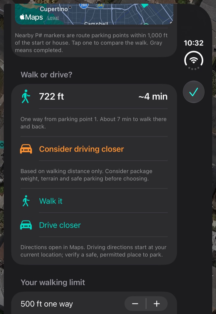
Walk or drive? for a heavy package to 552 Pettis Ave: 722 ft and about 4 minutes on foot from parking point 1, Consider driving closer, Walk it and Drive closer options, and a 500 ft walking limit
Heavy package: walk or drive? 552 is 722 ft from P1 on foot, over the 500 ft one-way limit, so it suggests driving closer. Walk it is still there.
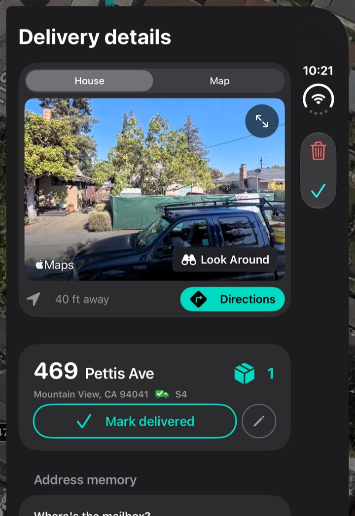
Delivery details for 469 Pettis Ave: Look Around photo of the house, 40 ft away with Directions, one package, a Mark delivered button, and Address memory below
Delivery details. Recognize the house from a street-level photo and check any saved notes.

Organizing the day

Saved routes are grouped by station. Once a route ends, its stops and deliveries are available in My Work.
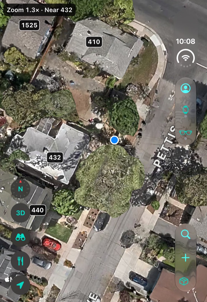
Route Postal Home with no active route: a full-screen satellite map with numbered houses and a plus button beside search
No route yet. The plus button beside search starts setup.
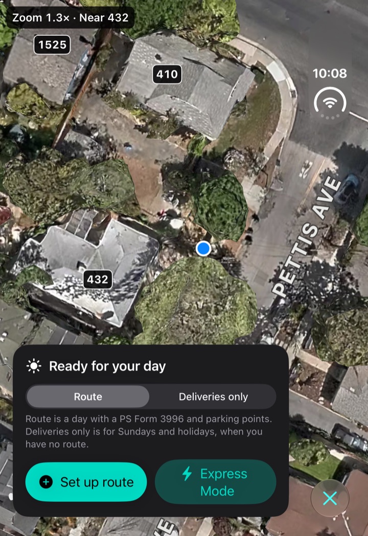
Route Postal Home after tapping the plus button: Ready for your day, with Route and Deliveries only, a Set up route button and Express Mode
Set up. The plus offers Route or Deliveries only, because not every day starts from a route. Express Mode reuses the last assignment.
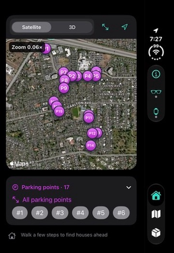
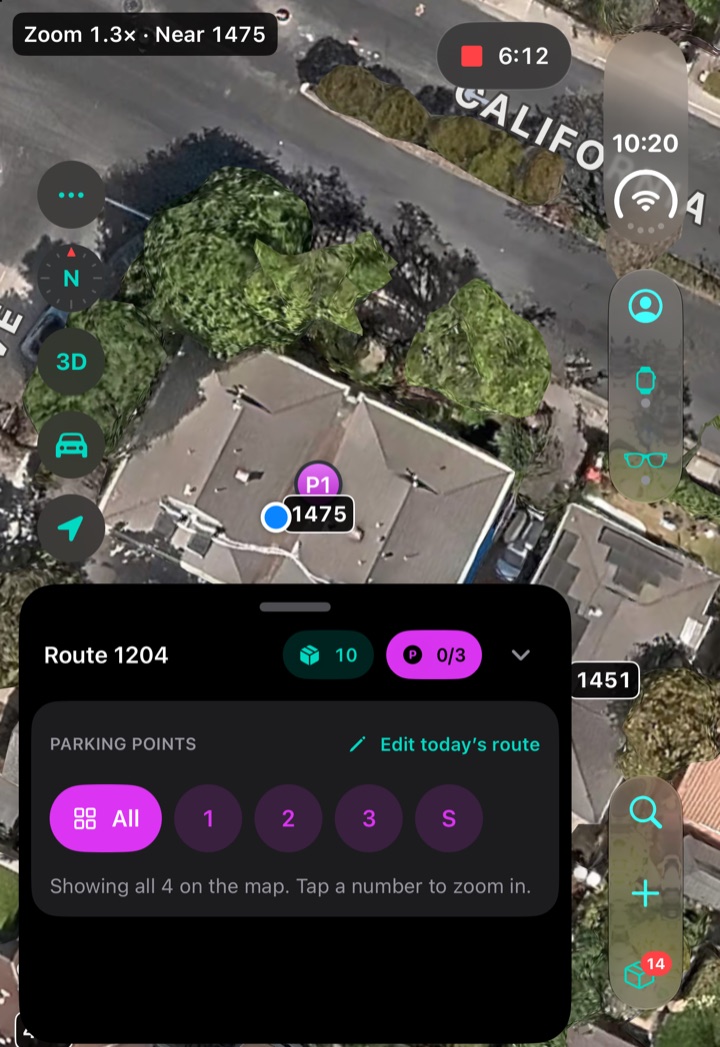
Route Postal with Route 1204 running: the route card with 0 of 3 parking points and chips for All, 1, 2, 3 and S, over a satellite map with P1 marked
Parking points. A chip for each point and the station. All shows them together on the map, and a number zooms in.
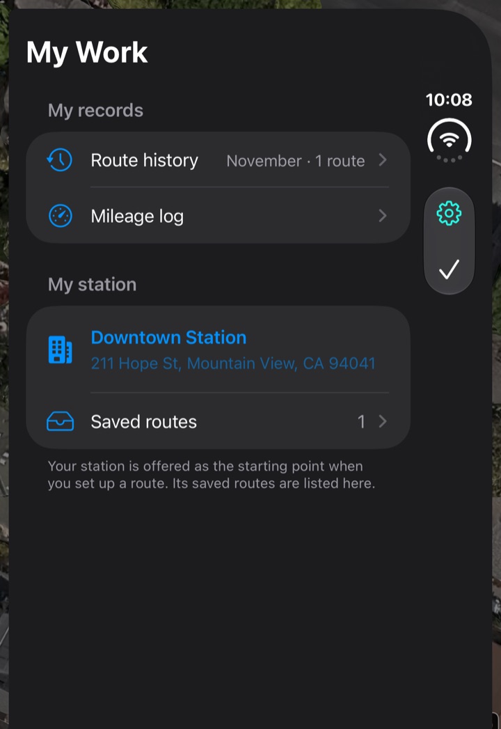
Route Postal My Work: Downtown Station with its address, a Saved routes row with 1, and Mileage log and Route history
My Work. The station first, with its saved routes underneath, then the records.
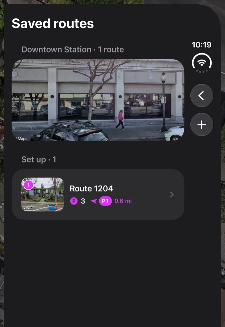
Route Postal Saved routes under Downtown Station: a Look Around photo of the station, and Route 1204 with 3 parking points, 0.6 mi to P1
Saved routes. Pick a saved route or import the form for a new one at your station.
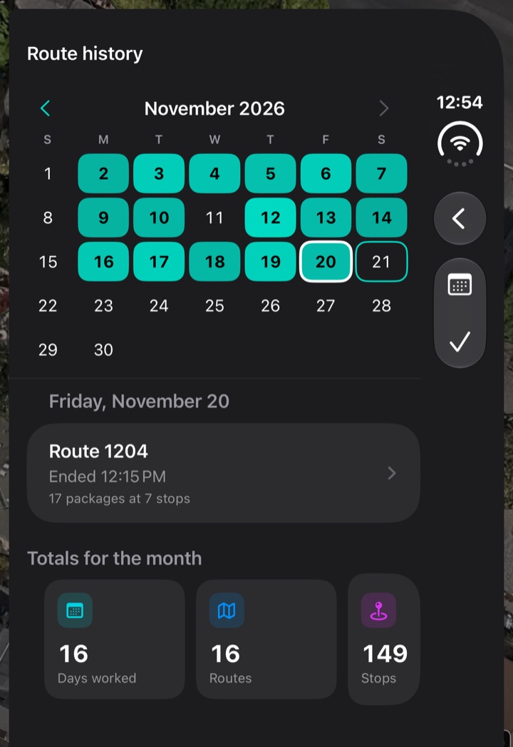
Route Postal Route history, month view: a November 2026 calendar with every day worked shaded by packages, Friday 20 selected showing Route 1204, ended 12:15 PM, 17 packages at 7 stops, and the first month totals: 16 days worked, 16 routes and 149 stops
Route history. See which days you worked and tap a day to review its routes.
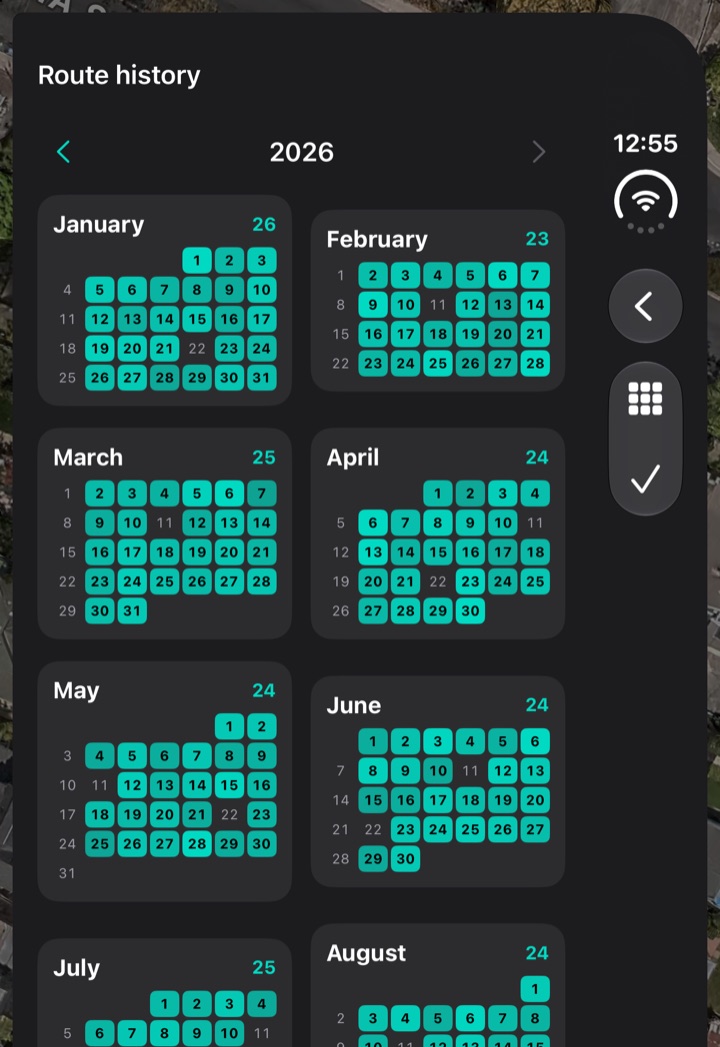
Route Postal Route history, year view: small calendars for January to August 2026 with every worked day shaded and each month’s route count beside its name
The year. Zoom out to see the number of routes worked each month.

04 · Setting up the route

Start with what the carrier already has.

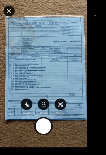
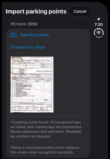
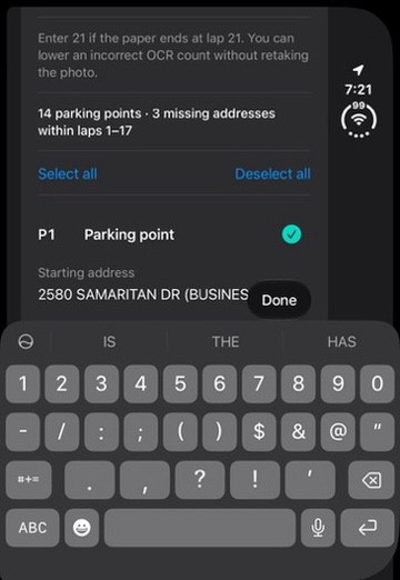
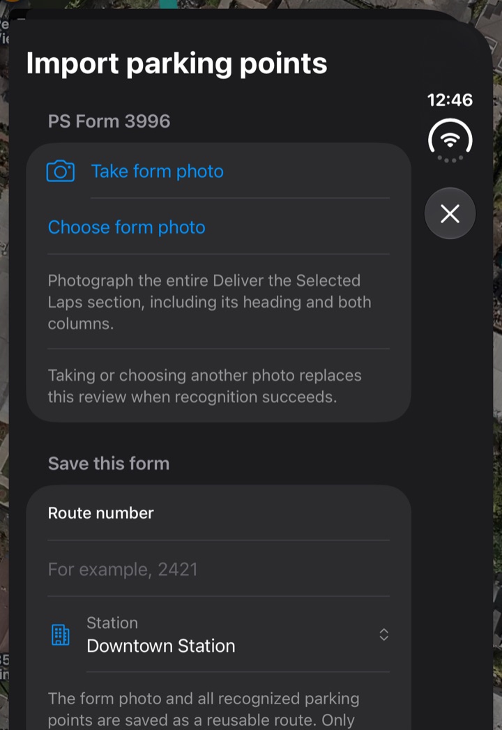
A photo of the scanner brings in delivery addresses. A photo of the postal route form, PS Form 3996, brings in parking points. Carriers review both before saving.

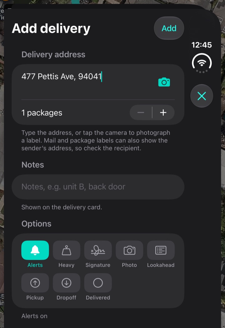
For one-off stops, type an address or photograph the label. The Form to map tab above walks through a real form.
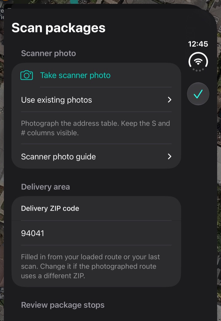
Route Postal Scan packages screen: Take scanner photo, Use existing photos, a note to keep the S and # columns visible, a Scanner photo guide, and the delivery ZIP 94041
Scanner photo. Package addresses. The screen asks for the S and # columns to stay visible, takes a new photo or existing ones, and shows the delivery ZIP it will use.
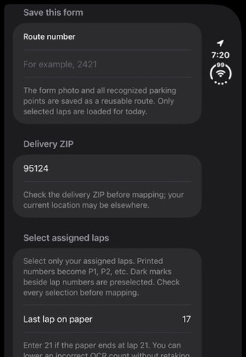
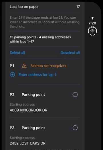
Route Postal Import parking points screen: Take form photo, Choose form photo, an instruction to photograph the entire Deliver the Selected Laps section, and Save this form with a route number and station
PS Form 3996. Numbered parking points, saved as a route: photograph the Deliver the Selected Laps section, then give it a route number and a station.
Route Postal Add delivery sheet: a delivery address field with a camera button, a packages stepper, notes, and options for Alerts, Heavy, Signature, Photo, Lookahead, Pickup, Dropoff and Delivered
Add delivery. Type an address, or photograph a label, with a package count, notes and options such as heavy, signature, pickup and dropoff.

05 · Design for a glance

As you approach, the next stop comes to you.

The same stop is shown at three levels of attention. The phone map is for planning, the Watch is for a glance, and the voice is for when your eyes are on a house number. This section follows one stop from 150 feet away to delivered, on the Watch.

The walk: the screen changes as you get closer

98–246 ft ahead
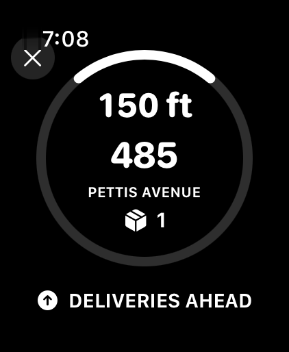
Apple Watch Deliveries ahead alert: 150 ft, 485 Pettis Avenue, 1 package

Deliveries ahead

A heads-up before the stop: how many are on this side and how far the first one is.

Route Postal“Continuing ahead, 2 deliveries on your right. First, 485 Pettis Avenue. Approximately 150 feet ahead along your path. 1 package to deliver.”

60 ft

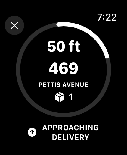
Apple Watch approach screen at 50 ft: a ring with a bright arc pointing toward the house, 469 Pettis Avenue, 1 package

Approach

A haptic tap, and the countdown takes over. The arc points at the house, and the taps come faster as you close in.

40 ft

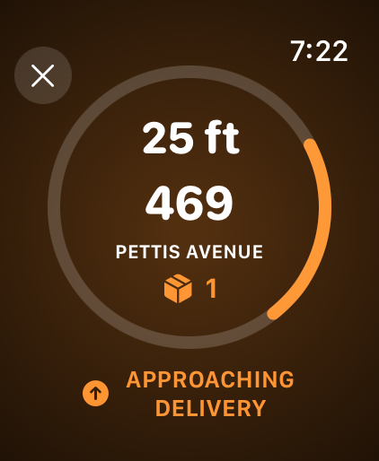
Apple Watch approach screen turned orange at 25 ft, the arc swung to the right as the house comes alongside

Spoken

Inside 40 ft the screen turns orange and the Watch says the stop.

Route Postal“Approaching delivery. 469 Pettis Avenue. About 50 feet, on your right. 1 package to deliver.”

20 ft

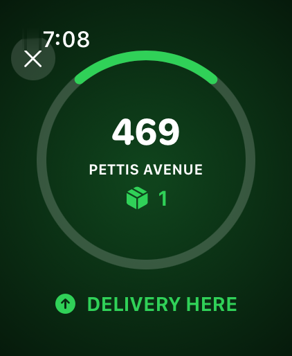
Apple Watch Delivery here alert on a green screen: 469 Pettis Avenue, 1 package

Here

Green means you are at the house. Mark it delivered with a tap, the Action Button or your voice.

Route Postal“Delivery here on your right. 469 Pettis Avenue. 1 package to deliver.”

Delivered

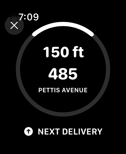
Apple Watch Next delivery preview: 150 ft, 485 Pettis Avenue

Next stop

The next stop, so you know where to head without looking. The iPhone says it; the Watch can preview it.

iPhone“Next delivery is 150 feet away, straight ahead. 485 Pettis Avenue.”

One screen, four colors

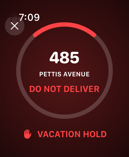
Every alert is the same screen. The ring, the distance, the house and the package count stay where they are, and only the color and the words change, so the carrier learns one screen and reads six alerts.

Apple Watch approach screen with five numbered callouts at the edge of the case12345
  1. The arc on the ring points at the house, from the way you are walking.
  2. The distance, in feet, counting down.
  3. The house: its number large, the street under it.
  4. The package count, so you know what to pick up.
  5. The label says which alert this is, in words.
Apple Watch Deliveries ahead alert on a black screen
White. Information: deliveries ahead, approaching, the next stop.
Apple Watch approach screen turned orange
Orange. Close: inside 40 ft.
Apple Watch Delivery here alert on a green screen
Green. You are here: within 20 ft.
Apple Watch Vacation hold alert on a red screen
Red. A problem: a missed delivery or a vacation hold.

When it interrupts

Two alerts are red because they ask for a different response. Everything else tells you where you are; these tell you to stop or turn around.
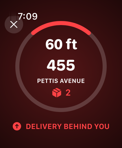
Apple Watch Delivery behind you alert on a red screen: 60 ft, 455 Pettis Avenue, 2 packages
Missed delivery

A stop that was ahead is now at least 49 ft behind (about 98 ft when GPS is uncertain), and up to 295 ft. The screen reads “Delivery behind you”.

Route Postal“You may have missed a delivery. 455 Pettis Avenue. Approximately 60 feet behind you along your path. 2 packages to deliver.”
Apple Watch Vacation hold alert on a red screen: 485 Pettis Avenue, Do not deliver
Vacation hold

Within about 98 ft of a house on hold, the Watch says not to deliver. Voice will never mark a held house delivered.

Route Postal“Approaching vacation hold. Do not deliver to 485 Pettis Avenue.”
Designed to be heard
  • Each stop is announced once, with the street said in full and “Heavy package” last.
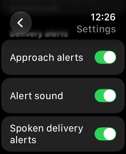
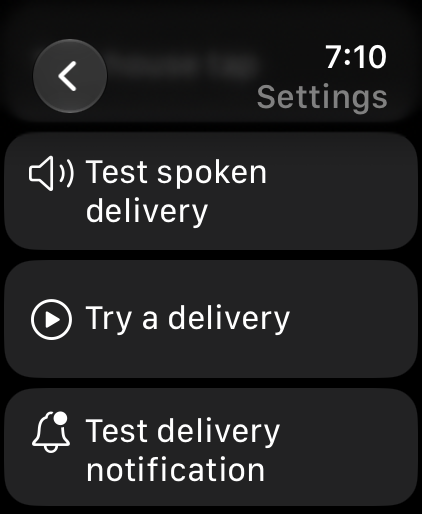
  • You can test or turn off spoken alerts on either device. By default, the phone stays quiet while the Watch speaks.
Designed to be safe
  • Voice asks for confirmation and checks the route again before marking a stop delivered.
  • The Ultra Action Button skips the confirmation on purpose, because the point is full hands. Either way, you have 20 seconds to undo by voice.

Alert reference

Pick an alert to see when it plays and what it says.

Apple Watch Deliveries ahead alert on a black screen: 150 ft, 485 Pettis Avenue, 1 package

Watch + iPhone

When it plays
A delivery is 98–246 ft ahead along your walking direction on the current street.

Route Postal“Continuing ahead, 2 deliveries on your right. First, 485 Pettis Avenue. Approximately 150 feet ahead along your path. 1 package to deliver.”

The same stop, on other surfaces

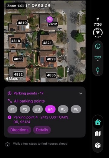
The phone map shows the whole day. The glasses show the same next-delivery card as the Watch, a map that turns as you walk, and the nearby houses.
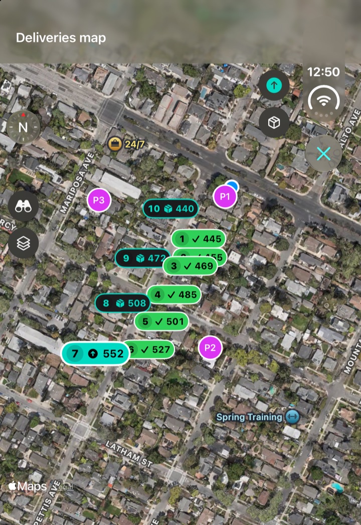
Route Postal full-screen Deliveries map: satellite imagery with every stop numbered in sequence, delivered stops in green, 552 highlighted as the next stop, parking points P1 to P3, and a Close button
Full-screen map. See the order of stops, completed deliveries, and parking points together.
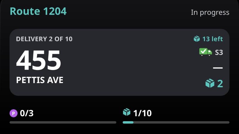
Meta Ray-Ban Display app: Route 1204 in progress, Delivery 2 of 10, 455 Pettis Ave, 2 packages, with parking point and delivery progress bars
Glasses overview. The same next-delivery card as the Watch, with route progress underneath.
Meta Ray-Ban Display app map: house numbers around 455 Pettis Ave, which is marked as the next package, with parking point P1 and a compass
Glasses map. See nearby house numbers, with the map oriented as you walk.
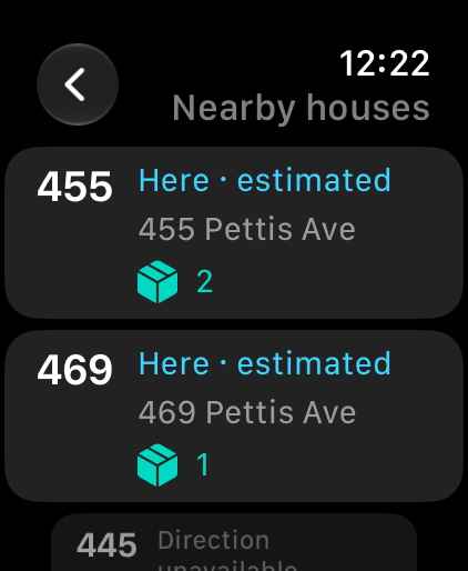
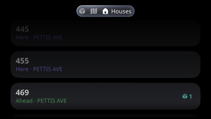
Meta Ray-Ban Display app Houses list: 445 and 455 marked Here, 469 marked Ahead with one package
Glasses houses. Nearby houses in walking order, with package counts.

06 · What the audit taught me

Testing showed where carriers could get stuck.

I reviewed 13 screens on an iPhone and Apple Watch. The biggest gaps showed up when a route ended, location dropped, or a carrier needed to back out.

01The route screen shows "Route finished" and "Route ended" in separate cards. One summary would make the next action clearer.
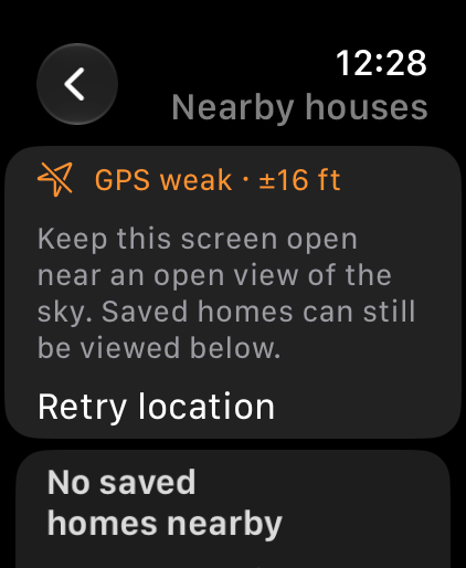
02The Watch's "Waiting for location" message needs a direct explanation and a way to recover.
03The form-import screen needs an explicit close control, to match the scanner-import screen.
04The compact phone layout uses icon-only navigation and very small helper text. Both need testing with first-time users and larger text settings.

I made the completed route easier to find, added a retry when the Watch loses location, and gave the import sheet a clear way to cancel. The phone’s icon-only controls still need testing with new users and larger text.

Closing the route
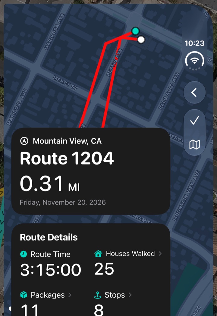
Route Postal Route 1204 record: a map of the walked path, 0.31 mi, route time 3:15:00, 25 houses walked, 11 packages and 8 stops
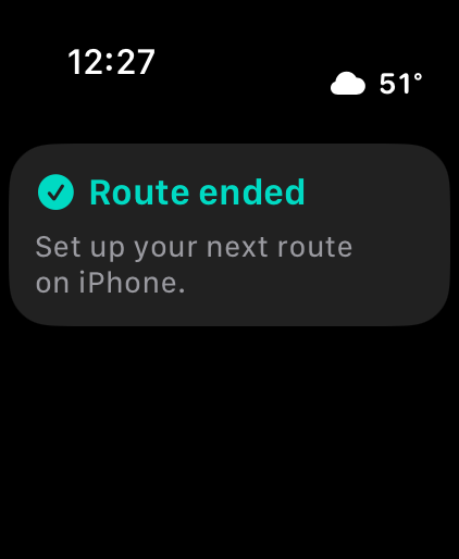
Route ended. The Watch sends you back to iPhone to set up the next route.
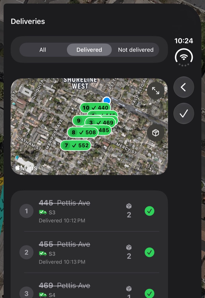
Route Postal Deliveries for the ended route with All, Delivered and Not delivered filters, a map of the delivered stops, and each stop with its delivery time
Review deliveries. Filter by delivery status and see when each stop was completed.

07 · What I tested

What I tried
  • On iPhone and Watch, I checked the map, route summary, saved routes, import screens, manual entry, and Watch settings.
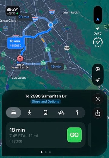
  • A real postal form went from photo to directions. The app recognized 13 parking points, and I added one by hand.
  • In simulators and a browser preview, I walked through a sample delivery across all three devices.
Still to test
  • On a real route, check how quickly carriers find the house, how often imports need corrections, and when alerts are early, late, or missed.
  • Check phone use while walking, the glasses map, and what happens outdoors, offline, or with the phone locked.
  • Test with VoiceOver and larger text, and measure whether the tools save time or reduce missed deliveries or phone use.
New in v1.0, built and not yet tested
  • Express Mode reuses the last assignment. Pickups sit alongside deliveries and use a barcode scan.
  • Address notes carry over between routes, and the phone can guide you back to the truck.
  • Alerts can follow one side of the street and begin around 60 feet out. On Watch, swipe to set a stop aside or use the Ultra Action Button to mark it delivered.
  • Route workouts can be saved to Apple Health, and weather shows when rain is approaching.
  • The glasses map can turn as you walk. If Apple Maps fails, it retries while the house and delivery lists stay available.

08 · What I’d test next

Try a full walking route with carriers. I want to see where the phone-to-Watch handoff or recovery steps get in the way, and whether the glasses help carriers keep their eyes on the street.

09 · Reflection

The carrier already has enough to pay attention to. The best thing each device can do is put the next decision within reach.
Next case studyThreat & exposure intelligence platformRead the case study